Tellus South West map viewer help
About the Tellus South West map viewer
The Tellus South West map viewer helps you explore data collected as part of the Tellus South West Project - a low-level airborne geophysical survey of the South West of England.
Navigation
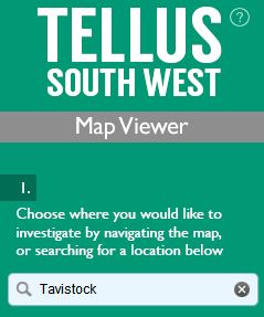
Choose where you would like to investigate. Enter a placename or postcode of interest in the search box indicated in the image below.
Move around the map by left-clicking and dragging the mouse in the direction you wish to travel. To zoom in or out of the map, use the plus and minus buttons on the bottom- left of the map. Alternatively, you can use the mouse wheel to zoom in and out of the map. Holding the Shift key and dragging a rectangle allows you to zoom in to that extent.

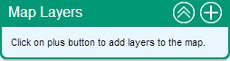
Add map layers
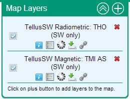
Click the plus button on the map layers tool (top-right of the map) to add data to the map.
Initially, all available map layers are listed, grouped by the organisation supplying the layers. Layers can be filtered (top right of map control) to just show layers from a particular organisation or relating to a particular topic. By selecting the ‘keyword’ option, a search term can be entered to return a list of matching layers.
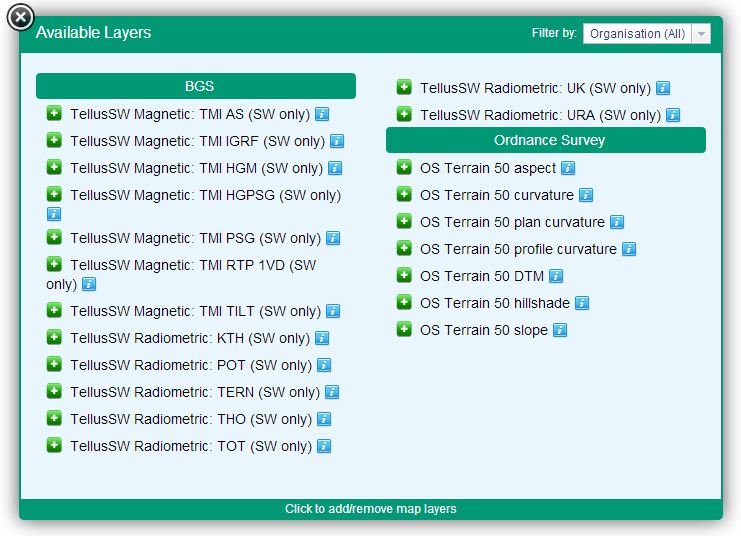
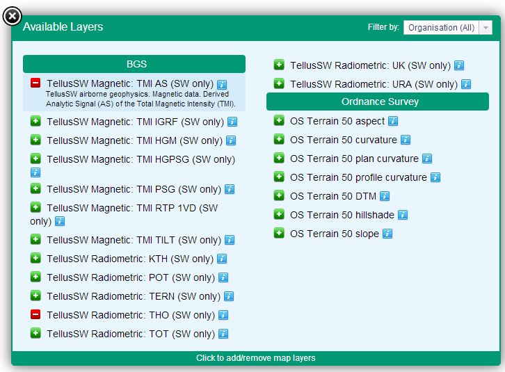
Click the information icon associated with a layer to view a summary of the layer. Click the green plus button to add the layer to the map. Any number of layers can be added although it is recommended to limit the selection to three or four layers at any one time for map clarity. Layers can be removed by clicking the red minus sign.
Once added to the map, the layers appear in the map control (top right of the map). Added map layers are automatically displayed on the map. A layer’s visibility can be switched off by unticking the checkbox associated with the layer in the map control. Clicking the red cross removes the layer from the map control.
Other functionality available for each layer:
![]() - provides further
information about the layer with a link to more detailed information
- provides further
information about the layer with a link to more detailed information
![]() - provides a
legend image for the data layer
- provides a
legend image for the data layer
![]() - allows use of a slider to change the transparency of the map
layer in order to compare the layer with others drawn on the map.
- allows use of a slider to change the transparency of the map
layer in order to compare the layer with others drawn on the map.
![]() - provides a
link to download the data behind the map layer
- provides a
link to download the data behind the map layer
![]() - provides a link (WMS) that
allows you to view the map layer in another system (e.g. GIS software or
alternative web-based map viewer)
- provides a link (WMS) that
allows you to view the map layer in another system (e.g. GIS software or
alternative web-based map viewer)
Querying map features
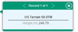
Click on a feature displayed on the map to find out about its attributes. All features from all currently displayed map layers will be returned. Use the arrows to step through the attributes of all features returned.
Additional tools
Further tools are available in the bottom-right of the map.

Basemaps
Click on a thumbnail to select from a range of map and imagery base layers. Options include Ordnance Survey OpenData, OpenStreetMap and aerial imagery layers.
Create PDF
Create a printable map. Enter a title and an A4-formatted map is created showing the current map extent and currently displayed layers. Legends for all visible layers are also included.
Further Help
For further help Email BGS.