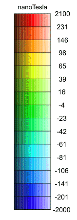
This low-resolution image has been produced from BGS airborne and marine magnetic data. The colour was generated using the BGS COLMAP software package. Colour levels are defined by histogram equalisation. Combining this image with the grey shaded relief image produces a similar image to the colour shaded relief image.
A published coloured shaded relief map, using the full resolution of the data and produced at a scale of 1: 1500 000, is available. Click here for further details. The map covers a larger area than this image, and includes additional data from other sources.
The data used to compile this image are available in various forms for academic and commercial licencing.
DATA PROCESSING
The data from surveys covering the UK mainland have been digitised from their original analogue form. Elsewhere data were acquired digitally. Standard methods of processing were used to remove diurnal and secular variations and to minimise line intersection errors. While efforts have been made to remove artefacts from the data, some may remain between adjacent datasets. Generally anomalies over man-made structures have not been removed.
The data have been interpolated onto a 1km x 1km grid using a variable tension technique, and smoothed.
REFERENCE FIELDS
Total field magnetic anomalies are referred to a variant of the International Geomagnetic Reference Field 1990 (IGRF90). In order to achieve an acceptable fit between adjacent surveys a correction was applied to IGRF90 for epochs prior to 1970, taking account magnetic observatory values.
Data visible at map scales above 1:625 000 scale.