Beta notes:
|
||
| Select base depth of horizontal slice using either: | ||
|
|
|
|
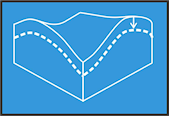
Below Surface
Horizontal slice depth specified in metres below ground surface
|
OR |
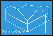
Elevation relative to OD
Horizontal slice depth specified in metres relative to Ordnance Datum
|
|
Minimum: 0m Maximum: Calculating... |
Maximum: Calculating... Minimum: Calculating... |
|
| Value: m | Value: m | |
| Select resolution for section image. Higher resolutions can take a minute or longer to generate: | ||
|
|
||
Hover over a row to highlight feature.
Double click on row to zoom to feature.
Double click on row to zoom to feature.
Location:
GeoIndex

Download
Get complete dataset.
Urban Interactive Models Toolbar
1) Use the dropdown to zoom to the extent of an interactive model
2) Choose from 'Borehole', 'Cross-Section' and 'Horizontal Slice' to query model
Modelled geology may differ from the geological map due to the constraints of the modelling process and the use of additional data not available at the time of map construction.
GeoIndex Onshore
Data
Welcome to the Onshore GeoIndex
To begin click on 'Add Data' to add a new layer to the map and zoom to a location using the 'Enter location' box.
The Onshore GeoIndex is now mobile friendly, opening with a simplified user interface on a smartphone or tablet.
 Loading layers...
Search
Spatial search: Click on 'Rectangle', 'Polygon' or 'Circle' buttons to draw a selection shape on the map.
Attribute query: Click on 'Query' button to search based on feature attributes.
Create PDF report
Generate a PDF report of the current map, legend and any search results
Enter a title for the report and click 'Generate Report'.
Report title:
Measure
Measure a distance or area
Click on a measure tool below and draw shape on map.